Jump to content
  • entries
    99
  • comments
    206
  • views
    208,347

Don’t Follow the Pixels


JRRT

1,342 views

If you’re someone who remembers BZPower back before the archive deletion and downtimes (I confess, I’m getting murky) and roughly prior to '08-'09, you might know me as a different person. I mostly lurked 'round this little forum called Artwork II, which was the place where all the shops and "sprite kits" were safely hidden from the world. Back then, most of my contribution to BZP came in the form of pixel art. Yeah, it was a different time.


Well, I haven’t done any pixel art for quite a while—nothing worth posting, at least. Even so, I get the hankering every now and then. And in fact, for a long time I’ve been wanting to start something long-term: a project to fiddle with in my spare time. Pixel art is quite cathartic, I find, and it’s actually a great stress-reliever. Go figure.


Unfortunately I haven’t really had that much spare time lately. That is, until last week. It was spring break...for students, at least. =P Even so, in between the grading, I did find a few moments to get creative:


isomn-prev1.png


isomn-prev2.png


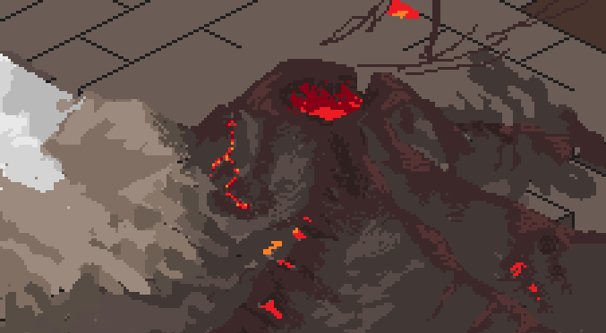
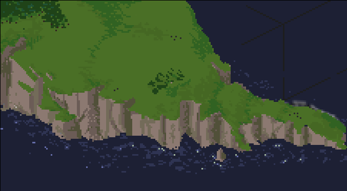
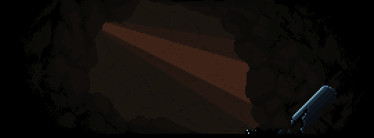
The project is a roughly to-scale isometric map of the island of Mata Nui; 1 pixel = ~.25 kio (these images are at about x3 magnification). I find landscapes to be very enjoyable to do, and isometric pixeling suits that pretty well. The images above should be kinda familiar: the Mangai Volcano and the southern tip of the island coast. This is only a few hours’ work, so it’s absurdly rough, but you should get the general idea.


So yeah, the plan is to keep messing around with it, and maybe post some updates as things progress. I confess, even now I’m still pretty much an amateur at this, but I hope I can do it justice. =P


JRRT

  • Upvote 9

5 Comments


Recommended Comments

Does the southern tip really have those sheer cliffs?


Personally, I'm still waiting for somebody to generate some really great 3D models of the island of Mata Nui from the greyscale bump map that Christian Faber lovingly provided. But sadly everyone who's tried to make it in either LEGO, or Minecraft, or any other 3D rendering software seems content to "wing it". I'd love to see a depiction of Mata Nui that you can view from all angles, because that would offer a fantastic opportunity to get a really legitimate sense of the island's scale and elevation.

  • Upvote 3
Link to comment

Does the southern tip really have those sheer cliffs?

Needless to say, there'll be plenty of artistic liberty going on here. The goal is fun, not 100% geographic accuracy.


However, if you take a look at this image from BS01, the southern coast does seem to be elevated. I don't know what the original source of that image is tho, or if it's even technically accurate. Ah well.


JRRT

  • Upvote 1
Link to comment

Dude. Man, good to see some old fashioned pixel art again. Can't wait to see the final project.


I suppose in the fashion of the old Artwork forums it'd be apt to say KUTGW, so, yeah, KUTGW.

  • Upvote 1
Link to comment
Guest
Add a comment...

×   Pasted as rich text.   Paste as plain text instead

  Only 75 emoji are allowed.

×   Your link has been automatically embedded.   Display as a link instead

×   Your previous content has been restored.   Clear editor

×   You cannot paste images directly. Upload or insert images from URL.

×
×
  • Create New...